1984, Academic Press, pbk
In stock, click to buy for £8.90, not including post and packing
Alternative online retailers to try:
Click here to access our prebuilt search for this title on Abebooks
Or click here to access our prebuilt search for this title on Alibris
Or click here to access our prebuilt search for this title on Ebay


|
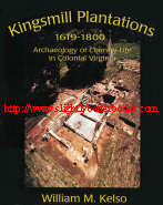
- Kingsmill Plantations 1619-1800. Archaeology of Country Life in Colonial Virginia [top]
Written by William M. Kelso
Published in 1984 by Academic Press, Inc. in paperback, 236pp, ISBN 0124034802
. Published as a volume within the Studies in Historical Archaeology Series edited by Stanley South with advisors: Charles E. Cleland; John L. Idol, Jr.; Mark P. Leone; Kenneth E. Lewis; Cynthia R. Price; Sarah Peabody Turnbaugh; John White
Library of Congress Cataloguing in Publication Data:
Kelso, William M.
-Kingsmill plantations, 1620-1800
(Studies in historical archaeology)
Includes index
1. Kingsmill Plantations Site (Va.) I. Title. II. Series: Studies in historical archaeology (New York, N.Y.)
F234.K56K45 1984 975.5'425 84-6337
ISBN 0-12-403480-2 (alk. paper)
Other Books in the Historical Archaeology Series:
Roy S. Dickens, JR., (Ed.) Archaeology of Urban America: The Search for Pattern and Process
Robert Paynter. Models of Spatial Inequality: Settlement Patterns in Historical Archaeology
Joan H. Geismar. The Archaeology of Social Disintegration in Skunk Hollow: A Nineteenth-Century Rural Black Community
Kathleen Deagan. Spanish St. Augustine: The Archaeology of a Colonial Creole Community
Kenneth E. Lewis. The American Frontier: An Archaeological Study of Settlement Pattern and Process
John Solomon Otto. Cannon's Point Plantation, 1794-1860: Living Conditions and Status Patterns in the Old South
About this book/synopsis: With this book, the author wanted to address two audiences at once: scholars, especially archaeologists and historians, and the seriously-interested-in-the-past general public. The book is intended to give both scholars and interested readers and fresh look at the rural history of Colonial tidewater Virginia through the lens of historical archaeology; it is designed to provide a more complete historical context for archaeological and anthropological conclusions (for the two disciplines are required to produce solid and useful results in historical archaeology: the ability to see and interpret significant particulars in light of historical documents as well as the ability to to recognize and interpret significant particulars in behaviour). The subject matter of the book is the archaeology of seven plantation sites at Kingsmill, near Williamsburg, Virginia, but it provides more than just a string of site reports and local history. It is an attempt to reconstruct a typical setting within which all strata of Virginia's rural society developed and changes over two centuries. For that reason, considerable effort has been made to place Kingsmill in the greater context of Virginia's colonial history and material culture, and to summarize the written documentation of the settlement and development of Kingsmill's homesteads and estates, while providing names and personalities for the sites that are discussed in detail
Contents:
1. Introduction
2. Above Ground: Context; Things; People
3. From the Earth: Shelter: Sites; Manor and Tenements; Mansions and Houses; Quarters; Outbuildings
4. From the Earth: Food and Drink: Gardens; Wells; Waste; Pots, Bones and Status
5. Pattern
Appendix A: Inventories
Appendix B: Kingsmill Ceramic Vessels: Type and Form
Appendix C: Faunal Analyses
Bibliography; Index
List of Figures:
Frontispiece: Archaeological sites at Kingsmill, Virginia
1. Location of Kingsmill, Virginia
2. 1972 excavation of brick-lined well
3. Pewter porringer recovred from Harrop well
4. Iron hoe blades
5. Artist's conception of early seventeenth-century settlement at Martin's Hundred
6. Sir William Berkeley
7. Robert "King" Carter of Corotoman
8. Conjectural view of Rosewall Plantation, Gloucester County, Virginia
9. Reconstruction drawing of the "ordinary beginners" house
10. Reconstructred yeoman's house
11. Timber framing at Cedar Park, Maryland
12. Solitude, late eighteenth-century hall-parlor, 1.5-story frame house
13. Monticello, circa 1809
14. Bird's-ey veiw of the Palace grounds
15. A rare view of slave life at an unknown plantation
16. First-quarter nineteenth century southern plantation buildings
17. Two-room Yoruba house in Nigeria, 1974
18. Slave quarters at Bremo Recess Plantation, Fluvanna County, Virginia
19. Negro House near Richmond, Virginia
20. Seventeenth-century place names at Kingsmill, Virginia
21. Signature of James Bray II as Justice of the Peace
22. Plan of the Williamsburg area by Desandrouin, 1781
23. One version of Lt. Simcoe's map of the capture of Burwell's Landing, 1781
24. Map prepared for French General St. Simon, 1781
25. Signature and Naval Office seal of Lewis Burwell IV
26. Sale advertisement for Lewis Burwell's Kingsmill Plantation
27. Detail from another version of Lt. Simcoes' maps
28. Early seventeenth-century tenant settlements at Kingsmill
29. Cross-section through main structural posthole of earthfast timber, "second stage" house, Littletown tenement
30. Posthole-postmold and rootcellar pattern of two periods of seventeenth-century earthfast houses and two eighteenth-century slave quarters
31. Coarse earthenware bowl from Littletown tenement
32. "De Pannenkoekenbakster," Pieter Roestraten
33. Tie-beam earthfast construction at St. Mary's City, Maryland
34. Artist's reconstruction of "second stage" earthfast house, Littletown tenement
35. The "manner house on the Clifts," an earthfast house site excavated at Stratford Hall, Westmoreland County, Virginia
36. Posthole patterns of early seventeenth-century house sites and eighteenth-century slave quarter at the Kingsmill Tenement and Kingsmill Quarter site
37. Archaeological plan and artist's reconstruction of "first stage" earthfast house
38. Archaeological plan and artist's reconstruction of "second stage" crossplan earthfast house
39. Archaeological plans of Colonel Thomas Pettus's Littletown, circa 1641-1700
40. Overhead view of Utopia earthfast house
41. Archaeological plan and artist's reconstruction of Utopia house, circa
1600-1710
42. Archaeological remains of Colonel Thomas Pettus's Littletown manor and quarter
43. Pettus manor house, east wing
44. Archaeological plan and artist's reconstruction of Pettus Manor, Littletown
45. Remains of casement window glazing and fluted delft bowl, Pettus's Littletown
46. Archaeological plans of Bray's Littletown, Burwell's Kingsmill, and Burwell's Landing ordinary
47. Aerial view of Littletown section of Kingsmill
48.
Mansion ruins at Bray's Littletown
49. Archaeological plan and artist's reconstruction of Bray mansion at Littletown
50. Burned English pearlware bowl-saucer, octagonal creamware plate, and polychrome Chinese export porcelain saucer
51. Open basement and kitchen at Burwell's Kingsmill before excavation, 1974
52. Aerial view of excavations at Kingsmill Plantation, November, 1975
53. Burwell mansion and kitchen after excavation, November, 1975
54. View of Burwell mansion ruins
55. Hand-wrought ground rod for eighteenth-century lightning-rod system
56. Voluted section of mansion step
57. Fragment of curved stone step
58. Elevation of Powhatan, James City County
59. Plan of William Byrd's Westover
60. Conjectural first-floor plan of Burwell's Kingsmill mansion
61. Remains of recent wharf, landing beach, and sit of ordinary at Burwell's Ferry Landing, Kingsmill
62. Overhead view of Burwell's Landing ordinary
63. The foundation of the central section of the Burwell's Landing ordinary
64. Archaeological plan and reconstruction of Burwell's Landing ordinary, circa 1775
65. Late eighteenth-early nineteenth-century tavern, Powhatan County, Virginia
66. Archaeological plans of fieldhand slave-quarters, Kingsmill
67. Earthfast servant's quarter at Bray's Littletown
68. Archaeological remains of unusual eighteenth-century earthfast house with interior root cellars
69. Revolutionary War pewter regimental button of the 80th Royal Edinburgh Volunteers
70. Burial of black female (?) with English clay tobacco pipe
71. Archaeological plan and conjectural reconstruction of quarter at Tuttey's Neck
72. First-floor plans of brick dependencies flanking Burwell's Kingsmill mansion
73. Excavated root cellars, south room kitchen dependency at Burwell's Kingsmill
74. Original stairway, office dependency, Burwell's Kingsmill
75. One of four heating fireplaces in second floor, half-story of kitchen and office
76. Partially intact foundation for brick "storehouse" near "kitchen" dependency, Burwell's Kingsmill
77. View of Kingsmill Quarter house remains
78. Excavated root cellar, Kingsmill Quarter
79. Pewter military button with the initials of the Royal Provincials under a crown
80. A representative collection of coinage from Kingsmill Tenement/Quarter site
81. Overhead view of excavated house site at North Quarter
82. Computer-drawn map of North Quarter house site and excavated yard
83. Cross-section through backfilled cellar, North Quarter
84. Collection of buttons recovered from North Quarter
85. Plan of timber building at Hampton Key
86. Map of Williamsburg area, 1781(?)
87. Plan of Littletown, showing outbuilding sites and boundary ditches
88. View of earthfast smokehouse with remains of brick firebox
89. Archaeological plans of earthfast barns at Littletown
90. Earthfast tobacco barn, St. Mary's City, Maryland
91. Tobacco-barn interior, St. Mary's City, Maryland
92. Surviving south and west wall foundations of dairy, Burwell's Kingsmill
93. Cross-section through drainage tunnel, Kingsmill dairy
94. The Burwell's Landing warehouse foundation during excavation
95. Conceptual reconstruction of landscapte dseign of Bray's Littletown, circa 1740
96. Page from 1736-1744 Bray Littletwon Ledger
97. Granite steps on terraces south of Burwell's Kingsmill mansion
98. Forecourt garden area, Burwell's Kingsmill mansion
99. Brick drain for garden path and brick garden pillar base
100. Carved portland stone pedestal found at Burwell's Kingsmill
101. Conceptual reconstruction of landscape design at Burwell's Kingsmill, circa 1760
102. Cross-section through wellshaft at Utopia
103. The partially dismantled and backfilled well at the Landing ordinary
104. Bucket from Burwell's Landing ordinary well
105. 1735-1750-style "wine" bottles from Bray's Littletown well
106. Intact "wine" bottle found in brick vault of Littletown well
107. Burwell well, beneath kitchen window
108. Cross-sections through five wells excavated at Kingsmill, 1972-1975
109. Mid-seventeenth century copper tobacco can
110. Pewter spoon bearing the name DAV[I]D MENETR[IE?]
111. North-south cross-section through one of six storage pits, Kingsmill Tenement
112. Cross-section through pit backfilled with domestic refuse and debris
113. Wine bottle and seals bearing anagrams
114. Domestic waste at Burwell's Kingsmill
115. Cooking pan (?) handle bearing the Logo LB.
116. Octagonal bottle with the seal of the merchant John Greenhow
117. Computer-drawn map of North Quarter site, showing ceramic fragments
118. Computer-drawn map of North Quarter site, showing bone fragments
119. Identifying and quantifying ceramics
120. "The Dinner"
121. Comparison of percentages of flatwares to hollowwares
122. Comparison of percentages of storage/preparation vessels to serving vessels
123. Comparison of percentages of pottery vessels by type
124. Comparison of percentages of drinking veselles and cups
125. Comparison of percentages of meat represented by faunal remains
126. Comparison of percentages of the slaughtering ages of cattle, based on analysis of faunal remains
127.
Comparison of percentages of the slaughtering ages of swine and sheep, based on faunal analysis
128. Surviving bones of a small, mature cow buried in the Harrop well, circa 1730-1745
129. Link from bracelet with chalcedony stone and enameled hand mirror or knife handle from Kingsmill Tenement
130. Assemblage of locally made pottery
131. Assemblage of colono-Indian clay tobacco pipes
132. Brass-winged lion harness or carriage boss found at Littletown Tenement, and rendering of Bray family crest
133. Sheet-copper lion's "gambe"
134. Glass wine-bottle seals of Kingsmill landowners
135. Mid-eighteenth-century wine bottles
136. Hoe gang, Edisto Island, South Carolina
137. A typology of changing styles of hoe blades
138. Waste shoe leather and a wooden shoemaking tool
139. Butt plate from a musket of probable German manufacture, marked, "Col. Verliac."
140. Afro-American quilts in front of black tenant farm quarters
141. Virginia black tenant farmer with "army surplus" clothing
142. A Virginia black tenant family in front of cabin
|
Historical Archaeology
Archaeology of the Southern United States
Archaeology in Virginia
Archaeology of the Colonial United States Period
|
1989, Fitzhouse Books, hbk
In stock, click image above to access the Amazon UK listing to buy for £5.20
Alternative online retailers to try:
Click here to access our prebuilt search for this title on Abebooks
Or click here to access our prebuilt search for this title on Alibris
Or click here to access our prebuilt search for this title on Ebay
 
|
About this book: Urban archaeology can be difficult, dangerous and expensive, yet nowhere is archaeological evidence so concentrated and so vulnerable as underneath our towns and cities. The redevelopment in town centres has produced many of the discoveries of the last 20 years, and much of the evidence discussed here derives from recent urban excavations. From the Roman citizens who built to last, and who were responsible for so many of Europe's most durable remains, to the tenement builders of the Middle Ages, Martin Carver surveys a period of 1500 years of urban development. He explains the character of urban deposits and how their excavation throws light on the economic and domestic situations of ordinary citizens in Roman, Saxon and medieval times. The remains found, which vary from grave goods and scraps of leather and pottery, to rotting posts and surviving stone buildings, show how each version of town life was different, though not necessarily superior to the other. The extensive bibliographical gazetteer provides the reader with source material on all the towns and subjects covered in the book. As an introduction to the world of urban archaeology-its achievements and its potential-this study will appeal to all who are concerned with it: from the academics and students who study it, the interested layman who wants to learn more about it, to the casual passer-by trying to interpret a dig. For Professor Carver has produced a readable overview of urban archaeology which also reflects his wide excavation experience and thus offers many controversial new interpretations, especially of the Anglo-Saxon period. His suggested methodology is also challengingly original
Contents:
List of illustrations
1. Underneath English Towns
2. Vericomodium: Roman ideal and reality
3. Dark earth and Dark Ages
4. The early English town
5. The medieval fabric
6. The urban motor
7. Private lives
8. Exploring cities: urban archaeologists in action
9. A discourse on method
Appendix; Abbreviations; Bibliographical gazetteer
Sources; Index
Illustrations
Ch. 1. Underneath English Towns
1. Photo, b&w, of a lorry jammed in the Roman Arch at Newport, Lincoln. Two thirds of the arch is now underground due to the accumulated debris of the Anglo-Saxon, Medieval and later town
2. Line drawing or sketch of a hypothetical slice of urban archaeological deposit showing different types of buried features like drains, walls, pits, dumps, spillages, dark earth and peaks of strata, etc. Drawn by Liz Hooper
3-6 Full page sketch, across pages 16 and 17, of types of buried construction found in towns including:
DRY SITE ARCHAEOLOGY: Post Hole, Post and Beam Structure, Stake Building, Wall Foundations, Wall Robber Trench, Grave, Piled Wall, Rubbish Pit, Quarry Pit, Bronze Worker's Pit, Cess Pits, Brick-Lined Cellar, Pottery & Malting Kilns, Hearth, Dump (Sleighted Rampart), Dump (Builders Debris) and Revetted Rampart
WET SITE ARCHAEOLOGY: Pond, Midden Heap, Stone-Built Sewer, Timber Plank Walls on Earth Fast Posts; Stone-Lined Culvert, Stone-Lined Well, Timber-Lined Well, Wattle-Lined Culvert and Wattle-Woven Walls
TRACE ARCHAEOLOGY: Rubble Platforms (Building Stances) including worn rubble inside and outside buildings;
Staddle Stones (Building Stance); Worn Rubble (path); Beam Impressions. All beautifully drawn by Liz Hooper
7. A medieval house and features buried below it recorded in the form of a scale drawing in Tamworth by Bob Meeson
8. B&W scale drawing showing sixteen centuries of walling conserved in the nave of the church of St. Mary Northgate, Canterbury.
The earliest wall of the third century AD carries a hint of crenellation on it probably because it was part of the Roman town wall (Source: Canterbury Archaeological Trust)
Ch. 2. Vericomodium: Roman Ideal & Reality
9. B&W photo of a street in Pompeii in South Italy, once buried by the eruption of Vesuvius in AD 79 (Source: Pictorial Colour Slides Ltd)
10. Aerial photo of buildings of the vicus along the road leading out of the Roman fort of Old Carlisle (Picture by Nick Higham and Barry Jones)
11. A 'Michelin guide' to the towns of Roman Britain showing the principal evidence discovered at the time of going to press (1987): Includes Caesaromagus (?Trinovantum) or Chelmsford; Calleva (Atrebatum) or Silchester; Camulodunum or Colchester; Corinium (Dobunnorum) or Cirencester; Durnovaria (?Durotrigum) or Dorchester; Durovernum (Cantiacorum) or Canterbury; Eboracum or York; Glevum or Gloucester; Isca (Dumnorium) or Exeter; Isurium (Brigantum) or Aldborough; Lindum or Lincoln; Londinium or London; Luguvalium (?Carvetiorum) or Carlisle; Moridunum (?Demetarum) or Carmarthen; Noviomagus (Regnensium) or Chichester; Petuaria (?Parisorum) or Brough-on-Humber; or Ratae (Coritanorum) or Leicester; Venta (Belgarum) or Winchester; Venta (Icenorum) or Caistor-by-Norwich; Venta (Silurum) or Caerwent; Verulamium or St. Albans; Viroconium (Cornoviorum) or Wroxeter. This table shows the maximum defended area in each town and whether it had a Forum, Amphitheatre, Theatre, Aqueduct, Baths, Mansio, Sewers, Temple, Grid of Streets, Houses, Shops, Crafts, Triumphal Arch, Waterfront, Mithraeum, Palace, Statues or Naval Base
p26. Map of England and Southern Scotland showing the Civitas Capitals, Colonia, Small Towns and Roman Roads
12. Scale diagram of Roman London showing the site of the fort, forum, baths, palace and the temple of Mithras (Source: Museum of London)
13. Scale diagram of The Roman Palace in London and the London Stone and Suggested Lines of Symmetry; plan of the buildings revealed by excavations by Peter Marsden (source: Museum of London)
14. Outline drawing of the Triumphal Arch at London, reconstructed from stone found in the riverside wall. Drawn by Tom Blagg (Museum of London)
15. B&W photo of the Roman town wall at Caerwent (Source: Pictorial Colour Slides Ltd)
16. Scale diagram of the Roman shops excavated at Newgate Street, London (Source: Museum of London)
17. Scale diagram and below it a black and white photograph of the London Mithraeum showing the aisle and nave. It was excavated by W. F. Grimes during the first great archaeological campaign in London during the 1950s. (source: W. F. Grimes and Routledge & Kegan Paul)
18. Scale drawing of a suggested reconstruction of the forcepump from Silchester used to raise water for the town supply (J. Wacher)
19. Black and white photograph of the Roman sewer found beneath Church Street, York (source: York Archaeological Trust)
20. Scale drawing of a Roman town layout - specifically the street system in Silchester in Standard Roman feet (After Crummy in Grew and Hobley, 1985)
21. Black and white photograph of part of a painted ceiling from Verulamium (St. Albans), which at the time of publication was on display in the Verulamium Museum
22. Black and white photograph of an interval tower on the Roman wall at York, excavated by the York Archaeological Trust (source: York Archaeological Trust)
23. Black and white photograph of the multiangular tower at York. The small neat stone-work in the lower half of the tower is Roman, whilst the tower was repaired, restored and carried up again to its present height in the Middle Ages (Picture: Philip A. Rahtz)
24. The Roman riverside wall at London under construction. This is a black and white evocation (historical reconstructive drawing) by Peter Warner (source: Museum of London)
Ch. 3. Dark earth and Dark Ages
25. A strictly provisional interpretation by Philip Barker of the plan of timber buildings and a street, the traces of which he has detected on the rubble of the largely demolished Roman town at Wroxter. These buildings are thought to have been erected in the 5th Century AD (Source and courtesy of: P. A. Barker)
26. Black and white regional outline map showing the shifting central places in the North Shropshire plain. The Wrekin was an Iron Age hillfort associated with the Cornovii; Viroconium Cornoviorum (Wroxeter) was their Roman capital; near Atcham, the cropmark of a settlement, probably middle-Saxon, has been seen from the air, whilst a late Anglo-Saxon burh was established at Shrewsbury, which remains the centre for the couny (drawing by Liz Hooper)
27.
Black and white photo of a corn-dryer, re-using a Roman altar, excavated by Philip Rahtz beneath Anglo-Saxon and later defensive banks at Hereford (source: Hereford Museum)
Ch. 4. The early English town
28. A table listing 58 late Saxon burhs from Abingdon and Aylesbury to Winchester, Worcester and York with symbols in the far right colum indicating what has been found there such as planning, defences, streets, property boundaries, churches, minsters, cemeteries, pottery kilns, other industries, environmental evidence, organic preservation, collegiate buildings, latrines, animal pens, commerce, fishing, mortar mixers, halls, iron smelting, ovens, bread ovens, water mill, pottery workshop, houses, wells, cellars, domestic, waterfront, gate, drains, shoemaking, belltower and bellmaking
29. Aerial black and white photograph of the middle-Saxon and later halls excavated at the west end of St. Peter's church, Northampton. The earliest building, analogous to contemporary rural 'palaces', points to a central authority as one kind of urban origin (source: Northampton Development Corporation)
30. Six sequential outline drawings showing the evolution of Anglo-Saxon and medieval defences excavated at Hereford, as realised by Ron Shoesmith (source: Hereford Museum)
31. Scale black and white plan and elevation of the late Saxon church of St. Oswald's, Gloucester, drawn by Richard Bryant (Carolyn Heighway). From 1977, the top most set of plans show the evolution of St. Oswalds through 6 periods: c.890, c.918, c.950, c.1000, Period 5, and Period 6 to 1086. There are two drawings below this: the bottom scale drawing is of the North wall of the nave - the North elevation. The top drawing here shows how the North wall looks as you see it, whilst the bottom plan below this shows which parts of the top drawing relate to which of the periods from period 1 to period 13
32. Black and white outline map of Southern England showing towns in existence which became domesday boroughs. These are Late Saxon planned towns and other burhs from excavated topographical and documentary evidence (Biddle and Hill, 1971, and elsewhere). The map shows towns with some evidence of rectilinear planning; reused Roman sites; and Burghal Hideage Sites
33. Black and white scale plan showing a ninth-century sunken-floored
building from London (source Museum of London)
34. A table containing 18 black and white scale drawings of Late Saxon buildings from towns and rural sites from a Hall in Goltho, Lancashire to a wattle and daub structure in Durham, County Durham. Drawn by Liz Hooper
35. A table containing 21 black and white scale drawings of Late Saxon structures from town and country. Drawn by Liz Hooper
Ch. 5. The Medieval Fabric
36. Scale map of early medieval Shrewsbury with three suggested areas of settlement which share this peninsula formed by a loop in the River Severn
37. Scale black and white map of medieval Shrewsbury. After the Norman Conquest, the castle and abbey provided two major nucleii for development. In the thirteenth century, a wall is thrown around the whole peninsula and a new planned quarter added to the piecemeal development inside the walls (source: Carver, 1978)
38. Three small black and white scale plans of Winchelsea - the planned town of Winchelsea can be seen in three stages: Medieval, Seventeenth Century and in 1975. It was never fully occupied and was abandoned as the sea retreated (source: D. Freke)
39. Black & white photograph and scale diagram ("Site Location Map 3: The Birmingham and Parsonage Moats") of the Birmingham
Moat on its discovery near the Bull Ring in 1975 (source: Lorna Watts)
40. Scale map in metres with key showing the components of early Lichfield. The brook beside the cathedral was damned to provide a fish-pond and head of water to drive a mill (Carver 1982a)
41. Black and white photograph of the town walls of Worcester being recorded in advance of the construction of a ring-road in 1977 (M.O.H. Carver)
42. Two scale black and white diagrams of Shrewsbury Abbey, with a diagram showing how it was originally on its own with gatehouse, dormitory, chapter house, Abbot's Lodging, Refectory, Guest Hall and infirmary and a modern later diagram showing developments such as the railway, railway viaduct, Coleham Head Road, houses and modern buildings much of which have dissected the site (source: Birmingham University Field Archaeology Unit)
43. Two black and white scale diagrams showing the water supply to Lichfield Close - one in 1821 and one in 1870 based on a sketch by Henry Burton, a plumber, on March 10th 1870
44. Black and white photograph showing the parish church of St. Helen on the Walls, York, and its graveyard during excavation (source: York Archaeological Trust)
45. Black and white photograph of the college of the Vicars Choral at the Bedern, York, during excavation (York Archaeological Trust)
46. Scale diagram and drawing (reconstruction) of the South Elevation of Priory Barn produced in 1977-1978 with a building analysis and key - this was the medieval still standing at the Priory in Taunton (source: Peter Leach)
47. Scale diagram of medieval tenements and their owners at Sidbury, Worcester, mapped from documents (source: Carver 1980)
48. Outline drawings of decorated pottery (figures seated on horses) finials originally from a roof-top in Bedford (source: D. Baker)
49. Scale diagram of a medieval cellar excavated
beneath a house at Winchelsea (source: D. Freke)
Ch. 6. The Urban Motor
50. Black and white photograph showing banking (banked walls) through the ages in a montage by Philip Rahtz. Such defences were there to protect not just the citizens, but also their livelihood and the investment of authorities in the creation of wealth
51. Histogram showing the numbers of towns founded in each century, following documentary records (source: Carver / Hooper)
52. Six black and white distribution maps of urban places thought to be active in six principal periods (all six on one page): Roman, Saxon, 11th / 12th Century, 13th Century, 14th Century and Modern
(source: Heighway, 1972; computer plot by Birmingham University Field Archaeology Unit)
53. Scale map and key
showing the reclamation of Bristol (source: Mike Ponsford)
54.Black and white pictures of both sides of an Anglo-Saxon silver penny of c.975 which show on one side a bust of Edward, King of the Angles, and on the other side the moneyer's mint mark STAEFF (for Stafford)
55. A composite black and white sectional drawing through the excavated riverside revetments of the Thames in London (Museum of London)
56. Black and white drawing giving an artist's impression of an Anglo-Saxon beaching place excavated in London. Vessels could here be floated on and off with the tide (source Museum of London)
57. Artist's drawing giving an impression of a 15th Century
dock at Baynard's Castle, London with a cargo ship using the quay. The photo below the drawing shows the quay as excavated (source: Museum of London)
58. Chart summarising what medieval craftsmen were named in historical documents. The chart looks at resources, producers, processors, manufacturers and menders
and splits them into 3 sections, namely: animals, vegetables and minerals. It shows the craftsmen's hypothetical interdepence
59. Scale diagrams of a medieval bell-pit excavated at Taunton in Canon Street, 1977. Pieces of bell-mould, originally supported upside down by posts and frame, were found in the pit (source: Peter Leach). The pictures shows an overhead view and sections
60. Artists impression of early medieval objects and waste from manufacture and lathe-turning in wood and bone at York (source: Liz Hooper, after York Archaeological Trust)
61. Artists impression of early medieval mortar mixer from Northampton (source: Northampton Development Corporation)
62. Chart showing scale diagrams of shoemaking and cobbling in early medieval Durham split into three periods (source: M.O.H. Carver)
63.
A scale diagram and drawing of an early medieval horizontally-driven mill excavated in Tamworth. Reconstruction by Philip Rahtz
64. Bread-oven or corn-dryer from thirteenth-century Hereford (Hereford Museum)
65. Scale ground plans of Roman urban buildings as in a street of shops, temples, forum, public baths, mansio and private houses (after Rivet 1964)
66. Scale map of Southern and Central England showing the distribution of three types of late Saxon pottery in the west and south of England. The more numerous eastern English industries (such as Stamford ware and Thetford ware) are not shown on the map (After Alan Vince)
67. Scale map of the streets, parishes and quarters in late medieval Southampton (Platt and Coleman-Smith, 1975)
Ch. 7. Private Lives
68. Photograph (black and white) of the skeletal remains of a man buried with his dog in Roman Ilchester (source: Peter Leach)
69.
Photograph (black and white) of a Roman lead coffin; and below it a stone sarcophagus
70. Graph plotting centuries against metres above or below the datum form a sequence of burial practices in the Cathedral Green cemetery in early medieval Hereford (Hereford Museum): 1. Simple Burials; 2. Charcoal Burials; 3. Coffin Burials; 4. Charcoal Burials; 5. Simple Burials; 6. Cist Burials; 7. Infant Burials
71. Black and white chart or poster of all the finds made in the household refuse found in the latrine of an abandoned Southampton house thought to have belonged to Richard of Southwick (After Platt and Coleman-Smith, 1975)
72. Pottery on the market in later medieval London. The charts show the Trig Lane excavation finds made during 1974-76. The diagram illustrates the life-span and evolution of the main Surrey Ware pottery forms (source: Museum of London)
Ch. 7. Exploring cities: urban archaeologists in action
73. Black and white photograph showing Philip Rahtz (University of Birmingham) on site at Tamworth
74. Black and white map of Wallingford (on-Thames) in 1973 (source: Simpson, 1973), showing threats to the archaeological evidence buried under a town. The threats are categorized as: recently developed; planning permission sought; ripe for development and car park
Ch. 8. A Discourse on Method
75. St. Mary's, Southampton. Excavations and observations 1825-1975. Observations and excavations made on the site of the early medieval trading site at Hamwih, Southampton, since 1825. Sites with Arabic numerals were done before 1972; those with Roman numerals are the S.A.R.C sites. Sites without numbers are where no archaeological excavations took place, although observations were made during buildingwork. Thanks to 150 years of persistent recording and the recent campaign of large-scale investigation, this outstanding settlement is beginning to be understood. Scale is given in metres and yards (source: Southampton Museum)
76. Black and white map of Britain showing single-period towns looking at the Roman, Middle Saxon, Late Saxon, 11th and 12th Centuries, 13th, 14th and 15th centuries. These places were, according to documents and archaeological evidence so far collected, occupied for one a few centuries of the whole urban continuum, and should thus be legible accounts for their particular periods, without too much interference from later development (see Appendix)
77. Black and white map of Britain showing 'multi-period towns'
- places which on present evidence are thought to have been continually occupied since their foundation
78. Black and white map to scale showing an Anglo-Saxon hinterland for Worcester drawn by Della Hooke. Dr. Hooke's description of the landscape, drawn from place names and other sources, locates fields, woods and meadows since vanished (source: Carver, 1980)
79. Black and white map of medieval urban functions in Sussex such as feudal towns, ecclesiastical towns, estuary towns and ports and market towns. The towns included are: Chichester, Midhurst, Petworth, Pulborough, Storrington, Burpham, Arundel, Littlehampton, Steyning, Bramber, Old Shoreham, New Shoreham, Brighton, Lewes, Seaford, Cuckfield, Horsham, East Grinstead, Hailsham, Pevensey, Battle, Hastings, Robertsbridge, Winchelsea and Rye (source: D. Freke)
80. Scale black and white contour map for Tamworth, showing the raised platform around St. Editha's Church indicating the probable site of Offa's palace, discovered by Bob Meeson (source: R. Meeson)
81. Top: A black and white photograph
of a map of Stafford dated to about A.D.1600, now in the William Salt Library. The town wall is partly of stone and partly timber palisade, and an enclosure is labelled 'castle built by Edward the Elder'. The burh was actually built by his sister Aethelflaeda, and more probably occupied the central area around the church. A modern archaeologist's map is shown for comparison (source: William Salt Library and Birmingham University Field Archaeology Unit). The bottom modern map of Stafford shows urban fabric in the settlement pre-1600 indicating extant buildings, documented buildings and buildings shown only on maps c.1600
82. Four scale maps with keys contributing to the archaeological site of Stafford town compiled by Jenny Glazebrook. The objective was to map the natural site available for settlement and predict the quality location and accessibility of archaeological strata. The four scale diagrams show excavations and recorded strata, a survey of cellars in Stafford, the geology (glacial sand and gravel, fluvio glacial gravel, Keuper Marl and Alluvium) and finally the depth of deposits (post medieval, medieval, Saxon/Roman, and Borehole)
83. The King's Pool Pollen Diagram - analysis by Sue Colledge. The King's Pools is now a peat deposit crossed by the Stafford ring-road. Pollen collecting in the Marsh gives a record of the surrounding vegetation over some 10,000 years. Stafford, it seems, was first exploited in the late Roman period when the growing of grain increased, and at the time of the Norman takeover, there was an increase in the production of hops or hemp (source: Birmingham University Archaeological Laboratory)
84. Black and white scale map of Medieval Worcester - mapped from documents, street names, buildings and archaeological excavations (source M.O.H. Carver)
85. Sampling strategy plotted onto a scale map for medieval Worcester based on the types of archaeological deposit and their predicted survival (source M.O.H. Carver)
86. Black and white photograph showing cellars used for strata-testing at Worcester (source: M.O.H. Carver)
87. Scale diagram of a test pit dug in cellar 1 and the interpretation - it shows the conclusions drawn before and after excavation (source: M.O.H. Carver)
88. A table (full page) showing the optimal information you would like to encounter in an archaeological context in terms of preservation, spacing and status. The author of the table has indicated what a "good site" would throw up for the archaeologist - mostly based around uncovering more complex evidence and information
89. Scale map showing the depth of deposits recorded in the City of London (source: Biddle and Hudson, 1973)
90. Black and white diagrams showing different urban deposits compared - some French examples (source: Carver, 1983b)
91. Photograph (black and white) of an excavation in progress at Ludlow in 1984. These excavations, on the site of a Carmelite Friary, were carried out by a professional team under Annette Roe, solely with the support of funds raised locally by public subscription (Birmingham University Field Archaeology Unit)
92. A table showing the information recovery levels used to control the rate and intensity of data retrieved on excavations (source: M.O.H. Carver)
93. Table of pictures and flow arrows showing the field research procedure from Reconnaissance to Evaluation to Excavation to Strategy to Analysis to Publication (source: M.O.H. Carver drawn by Liz Hooper)
94. Stratification diagram of Saddler Street, Durham City, County Durham, excavated in 1974, showing the stratigraphy of Site D. The diagram shows the sequence of layers and features from the earliest (bottom) to the latest times (top) and the 'lives' of features are represented by vertical arrows, and the diagram identifies structures which were in existence at the same time (Carver, 1979b)
95. Two page diagram showing the seriation of pottery types at Sidbury, Worcester. The x-axis shows the types of pottery in their suggested order of appearance, while the y-axis gives the feature numbers (mainly pits) in an order suggested by stratification. The order of both axes is adjusted to give the best diagonal, and the result is a model, showing the types of pottery in use in particular periods. Such diagrams may also show a number of other characteristics, such as episodes of dumping, of gradual growth, of levelling and of horticulture (source: Carver, 1980)
96. A full page synoptic view of assemblages recovered from a well-stratified sequence in Saddler Street, Durham, 1974 (source: Carver, 1979b)
97. A full page table showing the sequence of activities in three adjacent tenements at Worcester: 29 Sidbury (Tenement C); 25 Sidbury (Tenement B) and 23 Sidbury (Tenement A)
|
|